

User-first lead
City teams and private operators want systems that simplify daily work—not platforms that pretend complexity away. A user-centric drone fleet management approach starts with real workflows: scheduling, rapid re-tasking, and clear incident logs. That’s why tools tuned for the low-altitude economy matter; they map operational pain points to straightforward features like fleet orchestration and real-time telemetry so pilots and dispatchers actually adopt the tech.

What operators are trying to fix right now
Most teams face three recurring issues: fragmented command, weak situational awareness, and brittle integrations. Urban pilots need reliable BVLOS planning, geofencing applied automatically, and seamless airspace deconfliction with municipal services. Singapore’s Smart Nation experiments around drone corridors provide a clear anchor—cities testing live corridors learned that integrating a smart city management system with UAS controls reduces conflicts and speeds approvals, which matters when people expect fast, visible results.
Core capabilities that matter
A useful platform centers on a few concrete capabilities: low-latency telemetry for live tracking, deterministic geofencing to keep flights legal, and a digital twin of the operational area for scenario planning. Add APIs for easy data exchange and role-based access so dispatchers, pilots, and compliance officers see only what they need. The difference between a neat demo and sustained use is often small—good UX, predictable alerts, and clear audit trails. —Operators notice those details first, and they keep systems running day after day.
Common mistakes and sensible alternatives
Teams often pick tools based on flashy dashboards, then hit walls: vendor lock-in, weak BVLOS support, or slow telemetry that undermines trust. Two smarter paths: choose platforms with modular architecture or build minimal bespoke middleware to bridge gaps. Open-source flight-control stacks or neutral UTM connectors can be useful when you need transparency; proprietary suites work when they provide solid APIs and proven integration with municipal traffic systems.
Implementation checklist for adoption
Keep rollout practical. Start with a pilot zone, mirror operations in a digital twin, and collect UX feedback from end users—pilots and operations staff should shape workflows. Document failover behavior for connectivity drops and set clear escalation for airspace anomalies. Ensure telemetry logs are retained for incident review and regulatory compliance. This is about practical reliability: predictable handoffs, clear ownership, and measurable uptime.
Three golden rules for selecting a platform
1) Interoperability: Verify the platform supports standard APIs and can exchange telemetry with city traffic systems and emergency services. Integration reduces duplicated work and accelerates approvals.
2) Real-time situational awareness: Prioritize low-latency telemetry and deterministic geofencing so controllers can make safe decisions under load—delays cost trust and safety margins.
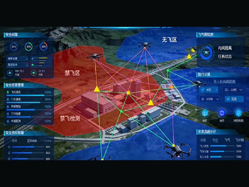
3) Scalability for operations: Confirm the architecture handles growth in both vehicle count and mission complexity—true scaling means fleet orchestration, distributed command, and secure data flows, not just bigger dashboards.
Closing thought
Takeaway: user-centered design, solid telemetry, and open integrations create systems teams actually use. When those elements line up, operations run smoother and neighborhoods notice fewer interruptions—people on the ground get safer, faster services. Icecypress Technology ties those threads together with platforms built for the low-altitude economy and smart city management system needs—practical, interoperable, human-friendly. —